

Start here
What Is the Pacific Coast Highway?
Plan your timing
When to Go and How Long to Allow
Build your itinerary
Key Stops Along the Route
Handle the details
Logistics: Driving, Parking, and Road Conditions
Manage your money
Budgeting and Overnight Stays
Avoid rookie mistakes
What First-Timers Frequently Get Wrong
What Is the Pacific Coast Highway?
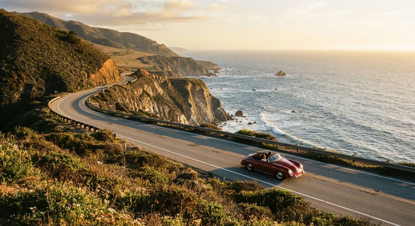
The Pacific Coast Highway — officially California State Route 1 — is one of the most celebrated drives in the country. It hugs the California coastline for approximately 650 miles, connecting the sun-soaked beaches near San Diego to the redwood country approaching Leggett in Mendocino County. While the full route is impressive, most travelers focus on the stretch between Los Angeles and San Francisco, which packs the greatest concentration of dramatic scenery into a manageable distance.
The road is far more than a highway — it's an experience. Clifftop turns over crashing surf, beach towns with distinct personalities, state parks, and a pace of life that actively resists rushing. For a broader foundation before you hit the road, the long-distance road trip planning guide walks through the essential logistics any serious road tripper should have sorted in advance.
California State Route 1
The official designation for the Pacific Coast Highway; a state-maintained road running along much of the California coastline.
Big Sur
A rugged, sparsely populated coastal region between Carmel and San Simeon known for dramatic cliffs, redwoods, and limited services.
Caltrans
The California Department of Transportation, which maintains state roads and provides real-time information on closures and conditions.
Pull-off / Viewpoint
A designated roadside area where drivers can safely stop the vehicle and step out to take in the scenery without blocking traffic.
When to Go and How Long to Allow
Spring (April–May) and fall (September–October) are widely considered the sweet spots for a PCH trip. Temperatures are mild, summer traffic has thinned, and the light is reliably beautiful. Summer is the most popular window but brings heavy crowds, especially around Big Sur and Malibu, and accommodation prices surge accordingly.
Winter travel is possible and often uncrowded, but rainfall increases the risk of Big Sur road closures — a real factor worth accounting for. Allow at least five full days for the LA-to-San Francisco run if you want to stop meaningfully. Seven to ten days lets you actually breathe.
Traveling Northbound Maximizes Viewpoints
Driving from south to north (Los Angeles toward San Francisco) keeps the ocean on your right side, making it much easier to pull over safely at viewpoints without crossing oncoming traffic. Most experienced PCH drivers recommend this direction, especially for first-timers who want to stop frequently.
Key Stops Along the Route
Driving north from Los Angeles, the route unfolds in distinct chapters:
- Malibu: Wide beaches, state parks, and the beginning of serious coastal scenery.
- Santa Barbara: Spanish Colonial architecture, a lively downtown, and some of the most walkable blocks on the California coast.
- San Luis Obispo: A college town with a thriving food scene and easy access to Morro Bay and the Hearst Castle area.
- Big Sur: The undisputed centerpiece of any PCH trip. Bixby Creek Bridge, McWay Falls, and Pfeiffer Beach demand time — not just windshield viewing.
- Monterey and Carmel: World-class marine life, the renowned aquarium, and the 17-Mile Drive along Pebble Beach. Carmel-by-the-Sea is genuinely charming.
- Santa Cruz: Boardwalk vibes, redwood hikes nearby, and an easy gateway into the Bay Area.
If you're tackling this as a solo journey, the solo travel guide for first-timers offers relevant advice on navigating new destinations confidently on your own.
Logistics: Driving, Parking, and Road Conditions
PCH is a two-lane highway through much of Big Sur, meaning a slow RV or road closure can halt traffic for miles. Build flexibility into each day rather than committing to a rigid schedule. Average speeds through the winding sections run well below posted limits, especially when you factor in stops.
Parking at popular viewpoints fills early, particularly on weekends. Arriving at key spots before 9 a.m. dramatically improves your experience. For Big Sur specifically, check Caltrans QuickMap (quickmap.dot.ca.gov) before each day's drive — landslide closures can appear with little warning and force significant detours.
Big Sur Closures Can Happen Anytime
The Big Sur coastline is geologically active and prone to landslides, especially during and after wet weather. Closures can last days or months and may require long inland detours. Always check Caltrans QuickMap (quickmap.dot.ca.gov) the morning of any planned Big Sur drive and have a backup inland route in mind.
Before departure, run through a proper vehicle check. The pre-drive safety checklist covers tires, fluids, emergency kit essentials, and the quick inspections that prevent avoidable breakdowns on remote stretches.
Budgeting and Overnight Stays
Accommodation along PCH spans the full spectrum — beachside campgrounds, budget motels, charming inns, and resort properties. In summer, even mid-range lodging books out weeks ahead. Reserving accommodation before you leave, especially for Big Sur campgrounds (which require advance reservations through recreation.gov), is strongly advised.
Camping is genuinely one of the most rewarding ways to experience the route — waking up above the surf in a Big Sur campground is hard to beat. For a complete look at structuring overnight stops and managing the financial side of a longer road trip, see the road trip planning start-to-finish guide. Food costs can add up fast in coastal towns; packing a cooler and shopping at local grocery stores is a practical way to balance the budget without missing out.
Caltrans QuickMap
California's official real-time road condition and closure map. Essential for checking Big Sur and other PCH segments before each day's drive.
Recreation.gov
The federal reservation platform for national forest and state-adjacent campgrounds, including many Big Sur sites that require advance booking.
What First-Timers Frequently Get Wrong
The most common mistake is trying to cover too much ground in too few days. PCH is not an efficient route — it's a deliberate one. Treating it like an interstate will leave you exhausted and disappointed. Build in unscheduled time and let the road surprise you.
A second pitfall is underestimating how different the northern and southern sections feel. The Malibu-to-Santa Barbara stretch is accessible and easygoing; Big Sur demands more patience and preparation. Don't let early miles set false expectations for what lies ahead.
Finally, stay flexible about direction and order. If closures or conditions push you to reroute, lean into it. The trip planning hub is a solid resource for staying organized when plans shift. And if you're curious how this coastal adventure compares to an entirely different American road trip style, the American South road trip guide offers a compelling contrast in scenery, pace, and culture.
Frequently Asked Questions
A nonstop drive from San Diego to Leggett covers roughly 650 miles and could technically be done in 12–14 hours. Realistically, most travelers take 5–7 days to enjoy the scenery, stops, and detours. Big Sur alone warrants at least a full day.
Most of the route is open year-round, but the Big Sur segment is susceptible to landslides and closures, particularly in winter and spring after heavy rain. Always check the Caltrans QuickMap before departure.
Southbound keeps the ocean on your left with fewer pull-off opportunities; northbound puts the ocean on your right, making it easier to pull over safely at viewpoints. Most experienced drivers recommend the northbound direction for first-timers.
A standard passenger car handles the route fine. An RV or large vehicle requires extra care on narrow Big Sur curves. A convertible or car with a sunroof simply adds to the experience.
Costs vary widely by season, accommodation style, and dining choices. Gas, lodging, food, and park entry fees can add up quickly along this popular corridor. Budget travel is possible with campgrounds and self-catering, but coastal towns skew toward higher price points.
Top stops include the Malibu coast, Santa Barbara's State Street, the San Luis Obispo area, Big Sur's Bixby Creek Bridge and McWay Falls, Monterey's Cannery Row, and the 17-Mile Drive near Carmel. Each offers a distinct flavor of California coastal life.
The content on this site is for informational purposes only and is not a substitute for professional advice. Always consult a qualified professional for guidance specific to your situation.